
Surveys play a crucial role in various industries by providing vital information that guides decision-making and planning. In particular, contour and detail surveys are widely used to gather specific data related to land features, elevations, and existing structures. This article explores what contour and detail surveys encompass, detailing the process, key elements, and the role they play across different sectors.
Defining a Contour and Detail Survey
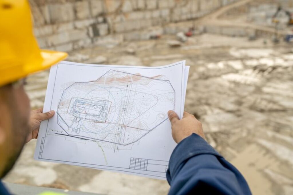
A contour and detail survey is a specialized land survey that captures the physical characteristics and topographical contours of a specific area. The goal is to create a detailed representation of the land’s features, including hills, valleys, and existing infrastructure. Such surveys are essential for ensuring accurate planning and development.
Contour surveys focus on the vertical positioning of land, indicating variations in elevation through a series of lines that connect points of equal height. Detail surveys supplement this information by providing precise details about man-made structures, utilities, and other significant land features.
The Basics of Contour Surveys
At its core, a contour survey relies on a series of systematic measurements taken at regular intervals across a piece of land. Surveyors use tools like levels, total stations, and GPS to record the elevation at various points. The data gathered is then used to create contour lines on a map that illustrate the terrain’s slopes and relief.
The resulting contour map is beneficial for several applications, including determining drainage patterns, planning roads, and assessing land for agricultural use. By understanding the landscape through contour lines, planners can make informed decisions that greatly impact the usability of the land. Additionally, contour surveys are instrumental in environmental studies, where understanding the topography can influence conservation efforts and habitat preservation strategies.
The Importance of Detail Surveys
While contour surveys provide an understanding of the terrain, detail surveys delve into the particulars of the area. These include identifying and documenting existing structures, roads, utilities, vegetation, and any significant features that might influence development. This type of survey provides a comprehensive view of the land and is crucial for effective layout planning and risk assessment.
Detail surveys are especially useful in densely populated areas where natural and man-made features overlap. By documenting these details, surveyors can help architects and engineers avoid potential conflicts, save costs, and streamline the construction process. Furthermore, the data collected in detail surveys can be invaluable for future urban planning initiatives, allowing for better integration of green spaces, transportation networks, and community facilities. This holistic approach not only enhances the functionality of the built environment but also promotes sustainable development practices that benefit both the community and the ecosystem.
The Process of Conducting a Contour and Detail Survey
Conducting a contour and detail survey involves meticulous planning and execution. It typically comprises several stages: initial planning and preparation, fieldwork and data collection, and data analysis and report generation. Each step plays a vital role in ensuring the accuracy and practicability of the survey results.
Initial Planning and Preparation
The first phase of a contour and detail survey requires thorough planning. This includes understanding the client’s objectives, the area to be surveyed, and any specific features that need documentation. Surveyors often conduct preliminary research to identify historical data and existing maps to inform their approach.
Once the survey boundaries are established, a plan outlining the survey methods, equipment, and personnel will be prepared. Clear communication with stakeholders about the survey’s goals and processes is also essential at this stage to align expectations and facilitate smooth execution. Additionally, surveyors may need to assess potential environmental impacts and legal considerations, such as land ownership and zoning regulations, to ensure compliance with local laws and regulations.
Field Work and Data Collection
Fieldwork entails physically visiting the site and gathering data. Surveyors utilize various measurement tools to assess the elevation at different points across the land, ensuring that the data collected is both accurate and comprehensive. The field team may employ total stations for precise angular measurements and employ GPS systems for location accuracy, especially in expansive areas.
During the data collection phase, surveyors also document any relevant features that could impact land use, including existing utilities and natural resources. This crucial information is recorded in the field notes to supplement the quantitative data collected. Furthermore, surveyors often take photographs and sketches of the site to provide visual context, which can be invaluable during the analysis phase. This attention to detail helps ensure that no significant elements are overlooked, thereby enhancing the overall quality of the survey.
Data Analysis and Report Generation
After data collection, the next step involves analyzing the gathered information. The survey data is processed using specialized surveying software to create both contour maps and detail layout plans. These products combine the elevation data with essentially all discovered natural and man-made features.
The final report generated from the survey provides a comprehensive overview of the land’s characteristics. It typically includes visual representations of the findings along with descriptive text outlining the potential implications for development, environmental considerations, and regulatory compliance. This report becomes a critical document for decision-makers in various projects. Additionally, the report may also highlight any challenges encountered during the survey process, such as difficult terrain or adverse weather conditions, which can inform future surveying efforts and improve methodologies. By providing a thorough analysis and clear recommendations, the report serves as a vital tool for stakeholders to make informed decisions regarding land use and development strategies.

Key Elements Covered in a Contour and Detail Survey
A contour and detail survey captures a variety of crucial elements that help inform planning and design decisions. Understanding these elements is vital for professionals engaged in land-use planning, construction, and environmental management.
Topographical Features
Topographical features are a primary focus of contour surveys. The contour lines drawn on a map illustrate changes in elevation, revealing insights into how water drains, the slopes for potential roadways, and other geographic characteristics that may need to be addressed in planning.
Along with elevation, such surveys also document natural features such as rivers, lakes, and wetlands, which can influence development due to environmental regulations and land-use restrictions. An accurate depiction of these elements is fundamental in ensuring sustainable development practices.
Natural and Man-made Structures
Detail surveys emphasize the identification of both natural and man-made structures within the surveyed area. This includes existing buildings, roads, fences, utilities, and any other human-made elements. Properly recording these structures helps avoid conflicts during future development projects.
Understanding the location and attributes of these features also assists in assessing the site’s capabilities and limitations. For instance, proximity to water bodies may impact construction designs or planning related to drainage and landscaping.
Property Boundaries and Landmarks
Accurate depiction of property boundaries is another essential component of contour and detail surveys. Defining these boundaries ensures compliance with zoning regulations and helps avoid potential disputes among neighboring landowners.
Landmarks, such as trees, utility poles, and existing fences, are often referenced in the survey documents to provide a clearer understanding of the land’s layout. These benchmarks help stakeholders visualize the property and serve as reference points in future planning and development efforts.
Interpreting the Results of a Contour and Detail Survey
Once a contour and detail survey is completed, understanding the results is vital for applying the information effectively. Interpreting the data requires recognizing patterns and reading various maps, each conveying essential messages regarding the land.
Reading Contour Lines and Elevation Data
Contour lines are visual representations of elevation and are usually drawn on a topographic map. Understanding these lines is essential for interpreting the terrain’s layout. Lines that are close together indicate a steep slope, while those spaced further apart signify a gentler incline.
Surveyors and planners use this information to anticipate water drainage, design roads, and create profiles for land development. Mastery of reading these data points can significantly influence the success of various projects, from landscaping to large-scale infrastructure endeavors.
Understanding Detail Survey Maps
Detail survey maps provide specific information on man-made and natural features within the surveyed area. These maps include annotations regarding property lines, structures, and environmental features, allowing for a holistic view of the land.
By effectively interpreting detail survey maps, stakeholders can make informed choices about land use, development strategies, and conservation efforts. Understanding how to read and analyze these maps ensures that decisions are made with the best available information.
The Role of Contour and Detail Surveys in Different Industries
Contour and detail surveys serve various functions across multiple industries, from construction and infrastructure development to environmental planning. Each sector benefits from the accurate data that these surveys provide.
Construction and Infrastructure Development
In the construction industry, contour and detail surveys are foundational to the design and planning process. They inform the initial stages of project development, laying the groundwork for road construction, drainage systems, and building layouts. Accurate survey data minimizes the risk of unexpected complications arising during construction. Check out more about Cadastral Surveys and Their Legal Importance
Surveying data is not only utilized by engineers but is also crucial for architects and landscape designers, who rely on a sound understanding of the topography when creating their designs.
Environmental Planning and Conservation
Environmental planners utilize contour and detail surveys to assess the ecological impact of potential developments. These surveys help identify sensitive areas that require protection and play a key role in conservation efforts. By understanding how human activities interact with the landscape, planners can implement sustainable practices.
Survey data can also assist in establishing natural resource management plans, ensuring that development does not come at the cost of environmental degradation.
Real Estate and Property Management
In real estate, having access to accurate contour and detail surveys is essential for property valuation and management. These surveys provide a clear understanding of land features, property boundaries, and zoning regulations, which are vital for prospective buyers and investors.
Additionally, property managers rely on this data to maintain and improve their properties, ensuring they comply with local regulations while maximizing usability. Overall, contour and detail surveys are indispensable tools that facilitate informed decisions in real estate transactions and property management.